The war between the Kingdom of Sardinia and the French Republic is often referred to, in Italy, as "The War of the Alps" - a way longer, and bloodier, historical precedent of the ill-fated World War II Italian attack across the French Alps in 1940.
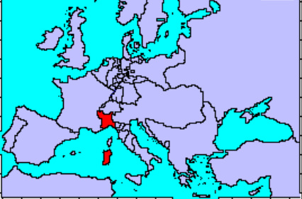
The map shows the location (in red) of the Kingdom of Sardinia in Europe, and its small size compared to its giant neighbors - France to the west, and the Austrian (later Austro-Hungarian) Empire to the east. It was composed of a continental portion, the core of which was the Italian region of Piedmont (Piemonte in Italian), and the island of Sardinia.
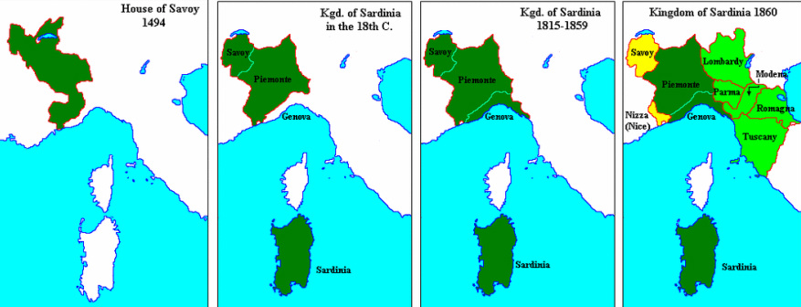
These pictures summarize the territorial expansion of the House of Savoy into Italy from the end of the 15th century AD to the year preceding the Unification of Italy (1861). The second map from the left shows the situation about the time of the War of the Alps (1792 - 1796).
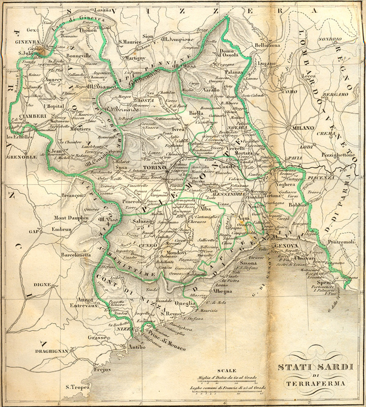
This beautiful mid-19th century map of the Sardinian Continental States (Stati Sardi di Terraferma) shows the Duchy of Genoa (today Liguria, the coastal strip to the southwest) as a part of the Kingdom; in 1796 it still was an independent State, the Republic of Genoa, neutral but friendly to the French - Bonaparte easily crossed it to bypass the Piedmontese fortified line along the Alps and enter Piedmont from the "soft belly" south. Note the Millesimo - Mondovì - Cherasco area, west of Cuneo: that's where the Sardinian Army carried out its fighting retreat. Since 1792, both Savoy (Savoia) and the County of Nice (Nizza) were occupied by the French.
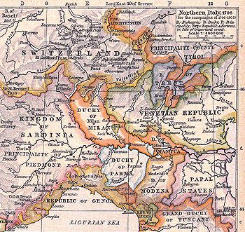
Political map of Northern Italy in 1796.
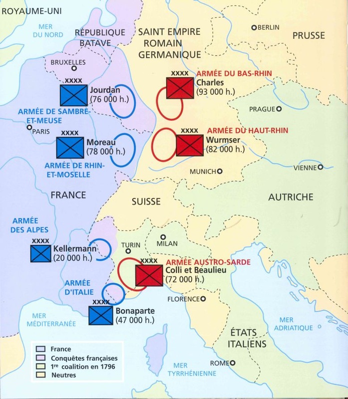
Strategic situation in Western Europe in 1796.
